GIS (Geographic Information System)
GIS (Geographic Information System)
ANAX-ITG has been a key player in numerous projects where GIS technology is critical for their successful completion. Specifically, the spatial analysis, visualization, and processing of spatial data are crucial for completing almost all construction, spatial intervention, and large-scale projects.
Case Studies
ANAX-ITG has contributed its expertise to projects where GIS played a vital role, such as the creation of a land registry to support 2D seismic surveys for hydrocarbon exploration in Greece, support for seismic survey operations in the field, and support for large-scale road mapping projects to create wind parks in highly mountainous areas throughout Greece.
Mapping and land registration of properties for Repsol s.a. and ELPE
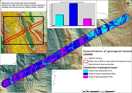
2D seismic projects on concession plots in Ioannina, Arta-Preveza, Aitoloakarnania, and Achaea.
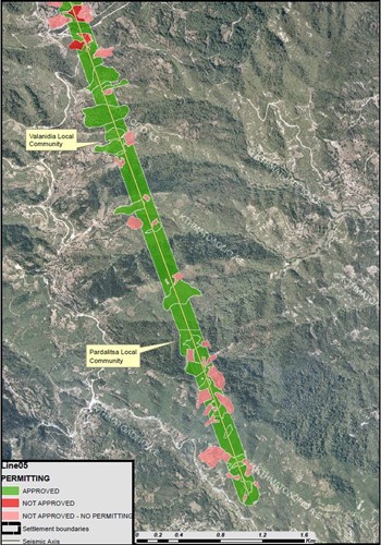
Implementation of land registry project
for the passage of high voltage cables at the Aeolic wind park in Kassidiaris.
Support in road mapping projects & Analysis of visual impact
Support in road mapping projects for wind parks to measure forest areas in Mount Parnon, Pavlina, and other locations.
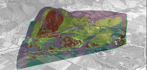
Analysis of visual impact and estimation of landscape degradation in environmentally and archaeologically sensitive areas from the implementation of photovoltaic power stations in Pavlini - Kefalonia, and other areas.
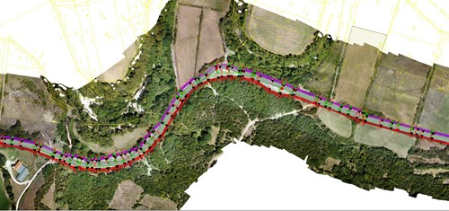
Detection and mapping
of underground high voltage cables for the Public Power Corporation (DEI) at the Aos Hydropower Plant.
